


A significant winter storm is expected to arrive today and last until mid-week.
Environment Canada has issued a Special Weather Statement for most of southern Ontario warning of a low pressure system, which is expected to track just east of Lake Erie and Lake Ontario this morning bringing rain, snow and strong winds.
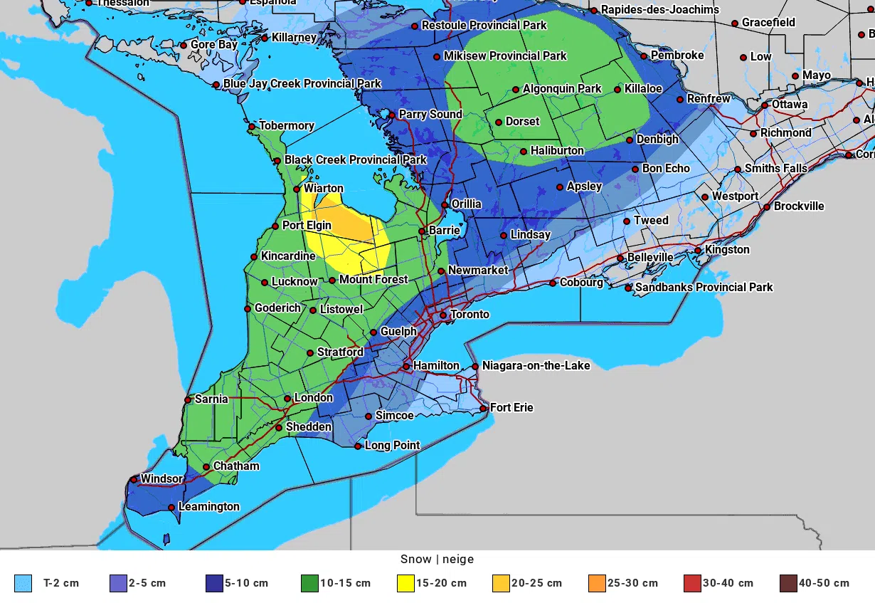
It says snowfall amounts of 10 to 20 cm are possible by Tuesday morning.
Then, the snow will continue Tuesday into Wednesday with additional snowfall amounts near 15 cm a possibility for some areas.
Difficult travel conditions are expected.
For the latest weather warnings from Environment Canada, please click here.
Good morning Ontario! Multi-day snowfall event expected today through Wednesday. Alerts are in effect for many areas, read them here: https://t.co/lPLaIYRtKr#ONstorm pic.twitter.com/O9bhMlBqhU
— ECCC Weather Ontario (@ECCCWeatherON) November 30, 2020
Significant snowfall beginning Monday.
Rain expected to transition to snow later in the day. Note this accumulation map is for Monday and Monday night only. Additional significant accumulations possible Tuesday in some areas.https://t.co/Uc1IB87tA3#ONstorm pic.twitter.com/0BMcMPzgrQ— ECCC Weather Ontario (@ECCCWeatherON) November 29, 2020